Thinking about using drone photos for your rural property in Bourbon? When buyers are weighing acreage, ponds, timber, and outbuildings, it can be hard to communicate the full picture with ground shots alone. You want to attract serious interest, shorten time on market, and avoid surprises later. In this guide, you’ll learn when aerial imagery truly helps, the legal basics to keep in mind, and how to plan a smooth shoot for Bourbon and Crawford County listings. Let’s dive in.
Why drone photos help rural listings
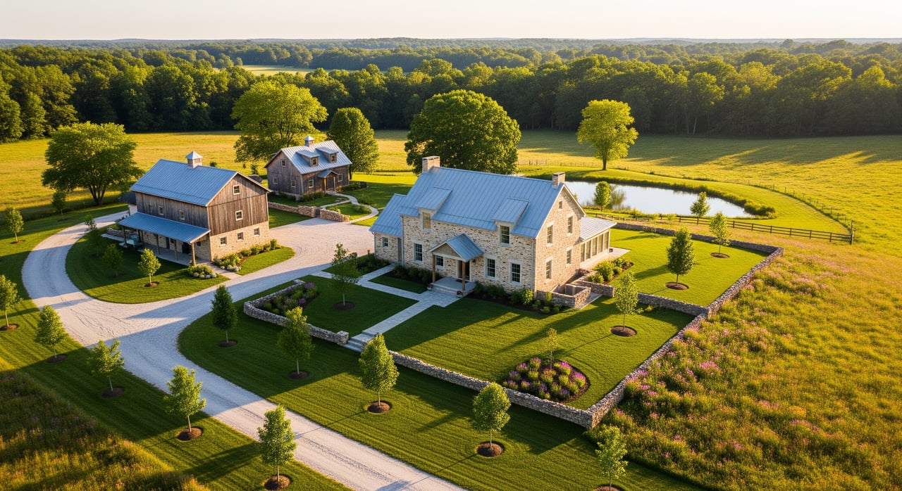
Aerials show the whole property at a glance. You can highlight acreage, field patterns, tree cover, ponds, creeks, ridgelines, fencing, driveways, and road access in a way ground photos cannot.
They reduce buyer uncertainty. Many rural buyers scan listings from a distance. Clear aerials help them decide whether a property fits their uses, from hobby farming to recreation, before a long drive.
They improve online engagement. High-quality visuals tend to pull more views and inquiries, and aerials help your listing stand out in land and acreage categories where buyers expect a broader perspective.
They aid valuation and negotiation. Transparent visuals of usable acreage, improvements, and constraints like steep slopes or floodplain help set realistic expectations and reduce friction later.
They complement maps and data. Pair aerial imagery with parcel lines, topo, soils, and flood layers to give buyers a fuller understanding of the land.
When drone photos make sense
- Large-acreage rural properties where layout matters.
- Properties with multiple outbuildings, ponds, timber, or varied terrain.
- Listings marketed to out-of-area buyers who rely on remote assessment.
- Parcels where access roads, gates, or fencing are key selling points.
Drone imagery may add less value for small in-town lots or parcels with heavy tree canopy that hides key features.
Legal and safety basics
- FAA rules: Commercial drone work requires a Remote Pilot Certificate under Part 107. Confirm your pilot is certified and follows altitude, airspace, and line-of-sight rules.
- Insurance: Ask for proof of liability coverage and understand policy limits for property or damage claims.
- Privacy: Get written permission from the seller and respect neighbors’ privacy. Keep flights focused on the subject parcel.
- Airspace checks: Verify local airspace and any temporary restrictions before a shoot. Airports and certain facilities may limit flights.
- MLS and platforms: Follow your MLS image policies. Avoid misrepresenting boundaries and use clear sources for any overlays.
Plan a smooth drone shoot
Use a quick checklist to stay organized:
- Get written permission from the seller and notify nearby neighbors.
- Confirm the pilot’s Part 107 certification and insurance.
- Verify airspace and timing for safe, legal flight windows.
- Pull the Crawford County assessor or GIS parcel map to prep boundary overlays.
- Stage the exterior: tidy gates, drives, and outbuildings; move vehicles and equipment if possible.
- Choose the right season and time of day for the features you want to highlight.
Must-have aerial shots
- Wide, high-altitude image showing the full parcel and nearby context.
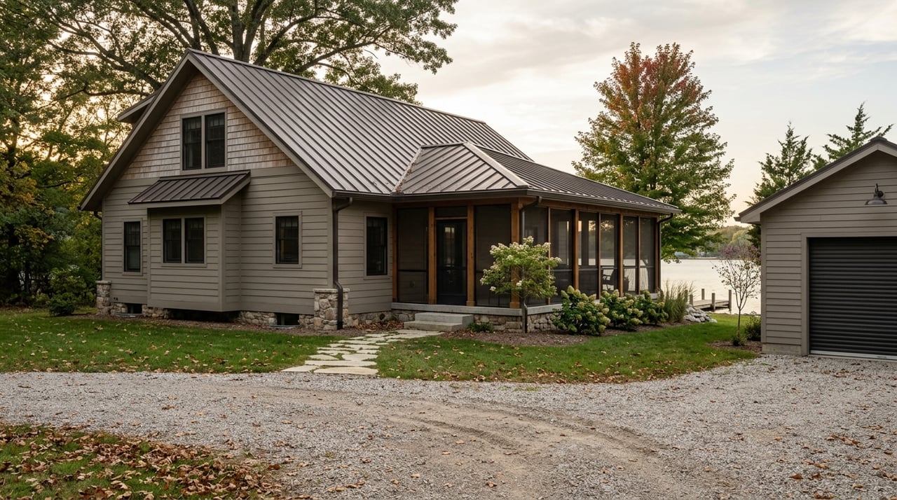
- Mid-altitude shots of the home, barns, shops, and fencing.
- Low oblique angles showing approach, driveway, and access roads.
- Close-ups of ponds, creeks, fields, ridgelines, and gates.
- Shots that show separation from neighboring properties and visibility corridors.
- If appropriate and safe, a short video approach or fly-through.
Combine media and maps
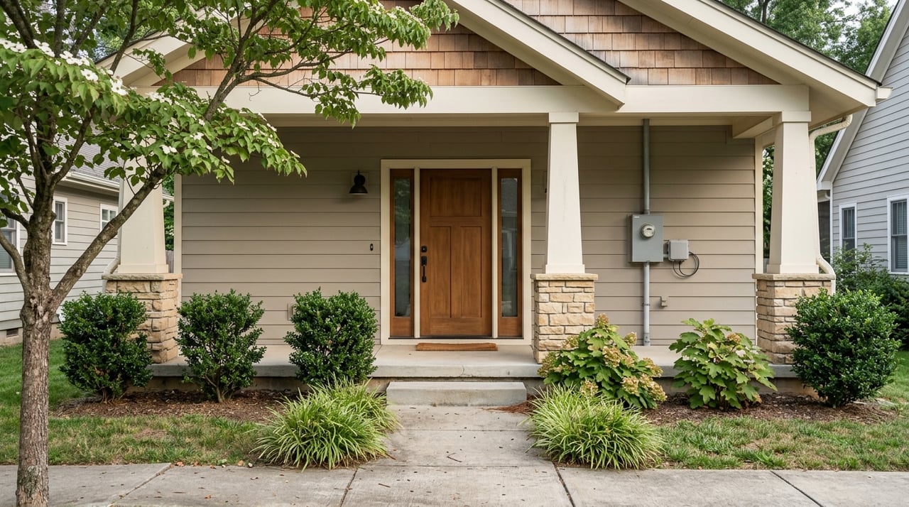
- Pair aerials with professional ground photos. Interior and exterior ground shots still matter.
- Add parcel overlays, acreage notes, and a compass rose for orientation.
- Provide links or references to county GIS maps, soil and flood layers, and utility info in your listing remarks or brochure.
- Keep images authentic. If you annotate boundaries, cite the public data source and date.
Costs and ROI to track
Pricing varies by vendor, deliverables, and any overlay or video editing work. Some agents and sellers share costs, while others treat aerials as part of a broader marketing budget. To gauge value, track:
- Time on market versus similar listings without aerials.
- Online views, saves, and inquiry volume after launch.
- Showing count and the share of remote vs local leads.
- Final sale price versus list price and relevant comps.
Because ROI varies by property and market, test on a few listings and compare results.
Local timing and seasons
In the Bourbon area, timing helps. Leaf-on seasons show green pastures, full ponds, and land use. Leaf-off seasons reveal terrain, fence lines, and structure placement. If crops or hay are involved, consider post-harvest timing to highlight usable acreage and access lanes.
Common concerns and solutions
- Privacy worries: Notify neighbors and keep flights brief and focused on the subject property.
- Boundary confusion: Use parcel data for overlays and avoid implying survey-level accuracy.
- Safety: Avoid flying over people, livestock, and occupied structures when possible.
- Logistics: Plan a 15–90 minute on-site window for flights, with edited deliverables often within a few days depending on scope.
Next steps for Bourbon sellers
- Verify your parcel data through Crawford County’s assessor or GIS before you shoot.
- Choose a Part 107-certified pilot with liability insurance and rural listing experience.
- Prep a simple checklist covering permissions, staging, flight timing, and deliverables.
- Confirm your MLS rules on aerial imagery and boundary annotations.
- Test aerials on one acreage listing and track the metrics that matter to you.
If you want a local, results-focused partner to plan high-visibility marketing for a Bourbon or Crawford County acreage, we can help you navigate the process, coordinate trusted vendors, and present your property with clarity. Reach out to the The Closers Real Estate Team to talk timing, preparation, and your goals.
FAQs
Are drone photos worth it for rural listings in Bourbon?
- Often yes, especially for larger parcels or properties with ponds, timber, multiple outbuildings, or complex access that buyers need to see clearly.
Who can legally fly a drone for my listing?
- A commercial operator with a FAA Part 107 Remote Pilot Certificate; hobbyist flights are not allowed for marketing a listing.
Can drone photos show my property boundaries?
- They can show context, but boundary lines require proper data sources; use assessor or survey information for any overlays and label them clearly.
Will neighbors object to drone flights?
- Some may have privacy concerns; notify them in advance and keep flights focused, brief, and limited to the subject parcel when possible.
How long does a drone shoot usually take?
- Many shoots range from about 15 to 90 minutes on site, with edited photos or video delivered within one to several days depending on scope.